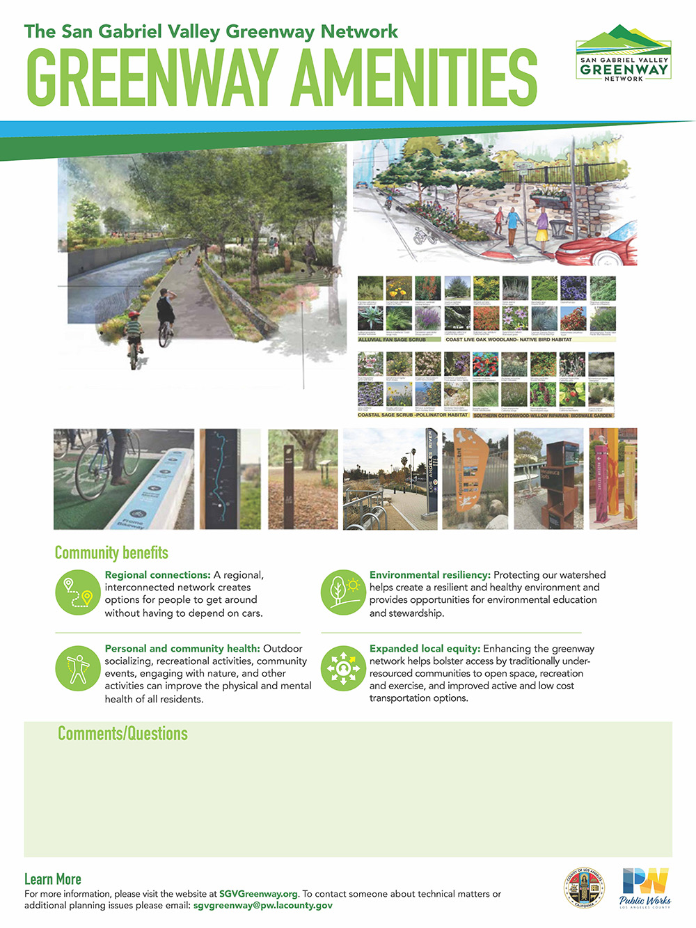
Explore the Network
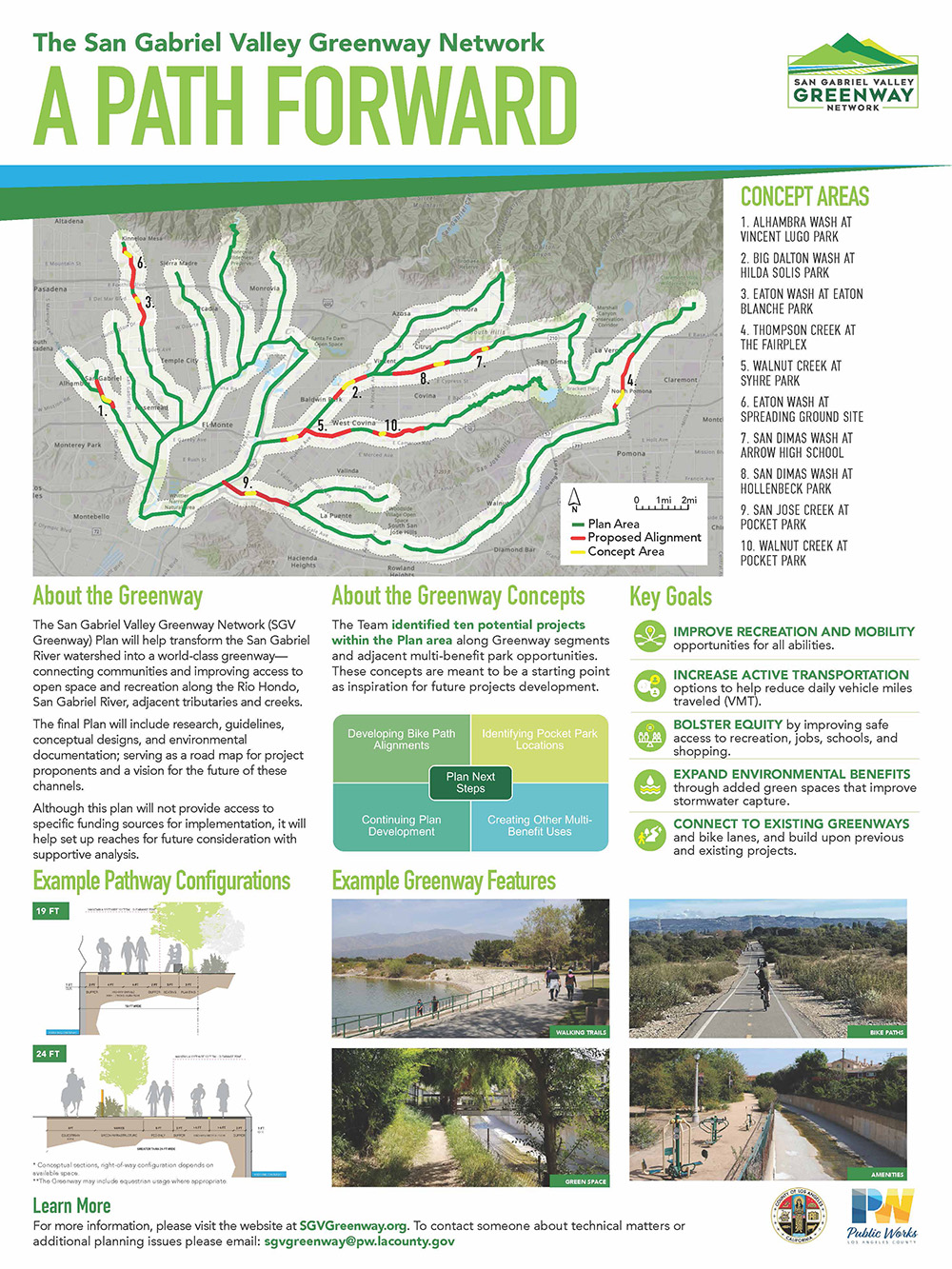
The map above shows the San Gabriel Valley Greenway Network Strategic Implementation Plan area, which includes the streams, creeks, and flood control channels (highlighted by green lines above) in the San Gabriel Valley watershed.
The SGV Greenway Network Plan creates a process to support greenway projects all along the San Gabriel Valley watershed, from an idea to completion, with the ultimate goal of creating an interconnected network of greenways throughout the San Gabriel Valley, connecting to existing bikeways (in red on the map above) and other trails.
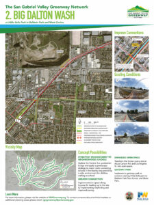
Conceptual Designs
The Team identified ten potential projects within the Plan area along Greenway segments and adjacent multi-benefit park opportunities. These concepts are meant to be a starting point as inspiration for future project development.